
Assam Floods and Flood Management in India
- 24 Jul 2026
In News:
Assam has witnessed its worst floods in over 60 years, affecting more than 8 lakh people and claiming over 30 lives. The disaster has once again highlighted the growing impact of climate change and the need for scientific flood management.
Why is Assam Highly Flood-Prone?
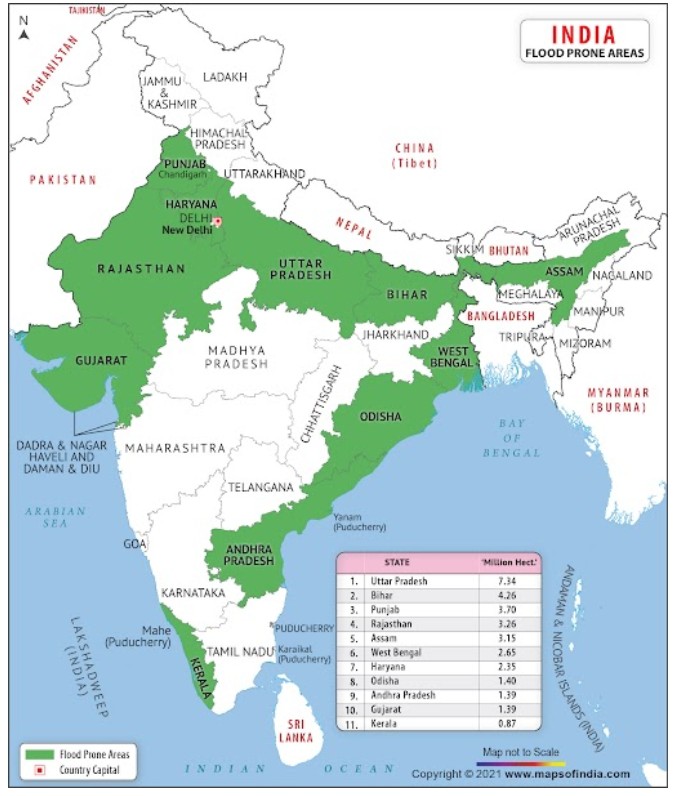
Assam lies in the Brahmaputra and Barak river basins, making it naturally vulnerable to annual floods. The Brahmaputra, one of the world's most sediment-laden rivers, deposits large quantities of silt as it enters the plains, raising the riverbed and reducing its carrying capacity.
Heavy southwest monsoon rainfall, coupled with upstream discharge from Arunachal Pradesh and Meghalaya, frequently triggers flash floods. Continuous riverbank erosion, embankment breaches, deforestation in the catchment, and increasing extreme rainfall events due to climate change further aggravate flooding. Nearly 39.58% of Assam's geographical area is flood-prone, almost four times the national average.
Major Causes of Floods in India
Floods in India result from both natural and human-induced factors.
Natural causes include concentrated monsoon rainfall, heavy siltation of Himalayan rivers, river course changes, Glacial Lake Outburst Floods (GLOFs), and cyclones along the eastern coast.
Human-induced factors include deforestation, encroachment of floodplains and wetlands, unscientific sand mining, reservoir mismanagement, excessive reliance on embankments, and rapid urbanisation that replaces permeable surfaces with concrete, leading to urban flooding.
Flood Management Measures in India
India has adopted both structural and non-structural measures to reduce flood risks.
Structural measures include construction of embankments, drainage channels, reservoirs, and implementation of the Dam Safety Act, 2021. Reservoirs are operated using Rule Curves to maintain flood cushions during the monsoon.
Non-structural measures include flood forecasting by the Central Water Commission (CWC), weather warnings by the India Meteorological Department (IMD), catchment area treatment, floodplain zoning, and community-based disaster preparedness.
Institutional support is provided through the Disaster Management Act, 2005, Flood Management and Border Areas Programme (FMBAP), and the National Water Policy, 2012.
Challenges in Flood Management
India's flood management continues to face several challenges. Constitutional division of responsibilities between the Centre and States often hampers integrated river basin management. Delays in project implementation, weak forecasting infrastructure, inadequate reservoir operations, and poor interstate as well as transboundary coordination reduce the effectiveness of flood-control measures.
In Northeast India, dependence on upstream river flows originating in neighbouring countries, difficult terrain, fragile ecology, and limited hydrological cooperation further complicate flood management.
Way Forward
India needs to shift from flood control to flood resilience by adopting Integrated River Basin Management (IRBM), scientific reservoir operations, effective floodplain zoning, nature-based solutions such as wetland restoration, AI-enabled early warning systems, and stronger institutional coordination.
Implementing recommendations of the Rashtriya Barh Ayog (1980), R. Rangachari Committee (2003), and aligning disaster management with the Sendai Framework for Disaster Risk Reduction (2015–2030) can significantly strengthen long-term flood resilience.