UN Map and India’s Territorial Boundaries
- 09 Sep 2026
In News:
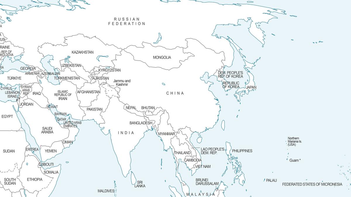
A new UN Geospatial world map, published in July 2026 using the Equal Earth projection, has drawn attention because Arunachal Pradesh and Aksai Chin are depicted between Indian and Chinese boundary/claim lines. The issue has emerged alongside the UN General Assembly’s adoption of the “Correct the Map” resolution on 4 September 2026. The resolution promotes more accurate equal-area cartographic representation, particularly of Africa, but is non-binding and does not determine sovereignty or territorial boundaries. It was adopted by 164 votes in favour, 1 against and 6 abstentions.
What is the “Correct the Map” Initiative?
The initiative, led by Togo and the African Union, seeks to address distortions created by conventional map projections such as the Mercator projection, particularly the apparent enlargement of landmasses at higher latitudes.
The Equal Earth projection, developed as an equal-area projection, represents the relative areas of continents more accurately. The UN resolution encourages the use of Equal Earth and other equal-area projections where relative size matters. However, it explicitly recognises that no flat map can perfectly represent the Earth's curved surface.
Importantly, the resolution does not alter sovereignty, territorial status, national borders or jurisdiction. UN member states also placed this understanding on record during the adoption process.
Why is the Map Significant for India?
The controversy concerns the depiction of two major areas in the India-China boundary dispute:
- Arunachal Pradesh: India considers it an integral part of the country, while China claims the territory and refers to it as “Zangnan”.
- Aksai Chin: India regards it as part of the Union Territory of Ladakh, while China exercises control over the area.
A map published or circulated through an international organisation can have diplomatic and perceptual significance, even though cartographic depiction itself does not establish legal sovereignty.
India therefore distinguishes between supporting equal-area cartographic principles and endorsing any particular map's depiction of disputed boundaries.
India’s Position
India supported the broader objective of the Correct the Map resolution but clarified at the UN that its vote should not be interpreted as endorsement of the Equal Earth projection or any specific map. India stated that it supports the broader consideration of equal-area projections.
This distinction is important because the resolution itself is designed around cartographic accuracy, rather than adjudication of territorial disputes. India's intervention is consistent with the position that questions of sovereignty and territorial integrity cannot be settled through a map projection.
Broader Geopolitical Significance
The episode illustrates how cartography can intersect with international relations:
- Maps influence perceptions: Maps used in educational, diplomatic and multilateral settings can shape public understanding of territorial geography.
- Territorial disputes require legal and diplomatic processes: A cartographic representation does not by itself confer or extinguish sovereignty.
- China-related diplomatic sensitivity: India remains attentive to international representations of its boundaries amid the unresolved India-China boundary dispute.
- Multilateral diplomacy: India's support for the underlying cartographic principle while distancing itself from specific territorial depictions demonstrates the importance of separating technical cartography from political recognition.
Way Forward
India should continue to:
- Maintain consistency in its official cartographic representations.
- Clearly communicate its position on disputed boundaries through diplomatic channels.
- Engage constructively in international initiatives promoting scientifically accurate cartography.
- Ensure that international organisations distinguish between map projections and political boundaries.
- Use established diplomatic and legal mechanisms for addressing territorial disputes.
Conclusion
The UN map controversy demonstrates that maps are not merely geographical tools; they can also have diplomatic and strategic significance. At the same time, the “Correct the Map” resolution makes clear that improving cartographic representation does not change territorial sovereignty. For India, the key challenge is therefore to support scientifically accurate global mapping while ensuring that cartographic practices do not create ambiguity regarding its stated territorial position.