NISAR Mission: A Landmark in Indo-US Space Cooperation and Earth Observation
- 29 Jul 2025
In News:
The upcoming launch of the NASA-ISRO Synthetic Aperture Radar (NISAR) satellite represents a landmark in Indo-U.S. collaboration in space science. Scheduled for deployment from Sriharikota onboard a GSLV Mk-II rocket, NISAR is poised to become one of the most sophisticated Earth observation missions globally, with wide-ranging scientific, environmental, and developmental implications.
Background and Mission Overview
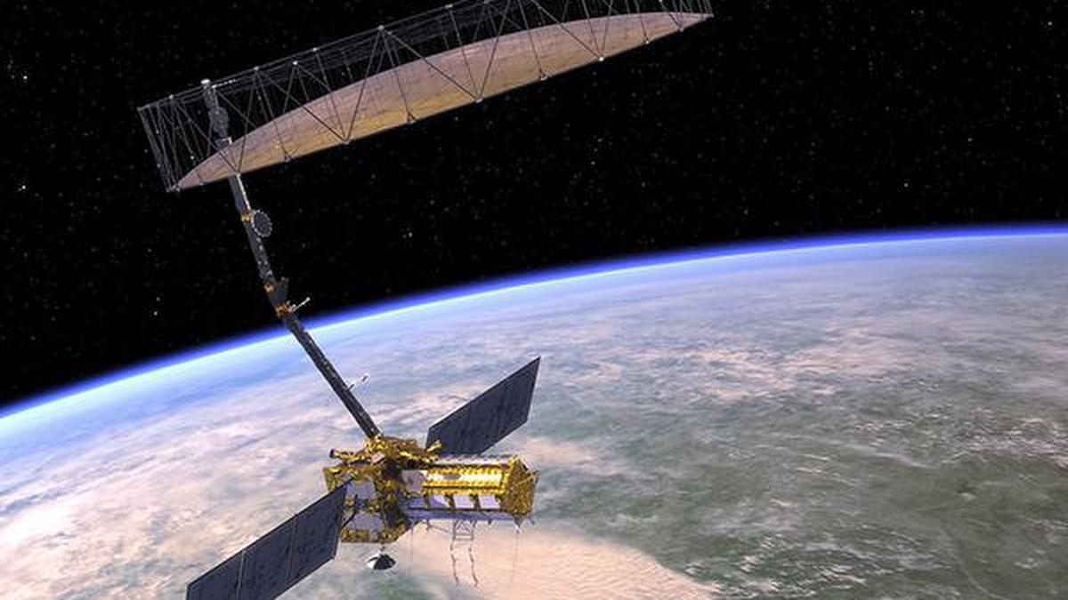
NISAR, developed jointly by NASA and ISRO over the past decade at a cost of approximately ?12,000 crore, is designed to provide high-resolution, all-weather, day-and-night radar imaging of the Earth’s surface. It is the first satellite globally to incorporate dual-frequency synthetic aperture radar (SAR)—combining NASA’s L-band radar (1.257 GHz) and ISRO’s S-band radar (3.2 GHz).
This dual-frequency capability enables it to penetrate forest canopies and surface layers, allowing comprehensive monitoring of dynamic Earth processes such as land deformation, biomass change, glacier dynamics, and infrastructure stability.
Technical Capabilities and Orbit
The satellite will operate from a sun-synchronous polar orbit at an altitude of 747 km. It features a 12-metre deployable mesh antenna and uses SweepSAR technology for electronically steering radar beams. With a 240 km swath width and spatial resolution between 3–10 meters, it can revisit every point on Earth every 12 days, facilitating consistent long-term monitoring.
Applications Across Critical Sectors
NISAR’s data will address six broad thematic areas:
- Solid Earth Processes: Detecting earthquakes, landslides, and urban subsidence.
- Ecosystem Dynamics: Estimating forest biomass, carbon stocks, and biodiversity changes.
- Cryosphere Studies: Tracking glacier movements and polar ice thickness.
- Coastal Monitoring: Observing shoreline erosion and marine hazards.
- Disaster Management: Generating damage proxy maps within five hours of events like floods or cyclones.
- Agriculture and Infrastructure: Supporting food security, yield estimation, and infrastructure health monitoring.
India-specific applications include real-time soil moisture analysis, crop forecasting, flood mapping, and disaster relief planning. The S-band will be operated more intensively over Indian territory, addressing national developmental priorities.
Collaborative Contributions
The mission reflects a balanced international partnership. ISRO has provided the spacecraft bus, S-band radar, telemetry systems, and launch services, while NASA has contributed the L-band radar, antenna system, onboard electronics, and global data infrastructure. Final integration and testing were conducted in Bengaluru, reinforcing India's growing capability in complex space missions.
Data Policy and Accessibility
Following an open data policy, NISAR will make its data freely accessible to scientists, governments, and the public. ISRO’s Shadnagar ground station and Antarctica node will handle domestic reception and processing, while NASA will manage global downlink via its Near Earth Network.
Significance for India and the World
NISAR enhances India’s Earth observation portfolio and strengthens climate resilience, agricultural sustainability, and disaster preparedness. It also elevates India’s profile in global space diplomacy, aligning with goals under climate action, SDGs, and science diplomacy.
In conclusion, NISAR is not just a technological achievement but a strategic asset for planetary monitoring and sustainable development, embodying the spirit of science for global good and showcasing India’s capacity to lead in international space cooperation.