National Waterway-57 (River Kopili)
- 05 Aug 2025
In News:
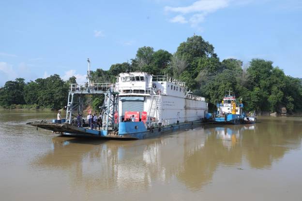
In a landmark development for sustainable logistics in the Northeast, the Kopili River (National Waterway-57) was operationalised with the maiden cargo movement of 300 MT of cement from Chandrapur (Kamrup) to Hatsingimari (South Salmara, Assam).
About the Kopili River
- Origin:Saipong Reserve Forest in the Borail Range, North Cachar Hills, at 1,525 m altitude.
- Length: 256 km (78 km along the Assam–Meghalaya border; 178 km in Assam).
- Basin Coverage: Flows through Meghalaya and Assam, making it an interstate river.
- Significance: Largest south bank tributary of the Brahmaputra in Assam; traverses North Cachar Hill, KarbiAnglong, Nagaon, and Morigaon districts.
- Agricultural Zone: Supports cultivation of rice (winter, summer, autumn), wheat, mustard, and rapeseed in Kamrup and surrounding areas.
Strategic and Policy Significance
- Economic Impact: Reduces road congestion, lowers logistics costs, and provides an efficient alternative for bulk cargo. The trial run replaced the equivalent of 23 truckloads of cement.
- Environmental Gains: Inland water transport curbs emissions and promotes sustainable logistics.
- Regional Development: Enhances connectivity for riverine communities, boosts trade, and unlocks economic opportunities in Assam.
- National Integration: Aligns with Maritime India Vision 2030 and PM Gati Shakti, which seek to create multimodal, integrated transport infrastructure.