Strength of Cloud Bands and their role in Indian Monsoon
- 01 Apr 2025
In News:
A recent study by the Indian Institute of Science (IISc) has shed new light on the role of equatorial cloud bands in determining the movement and intensity of monsoon rainfall over India. These insights could enhance the accuracy of seasonal and sub-seasonal climate models.
Key Findings of the Study:
- Importance of Cloud Band Strength:
- The northward movement of monsoon cloud bands—crucial for triggering wet spells in India—is not guaranteed. Only strong cloud bands originating near the equator successfully propagate northward.
- Weak cloud bands fail to initiate wet spells, countering earlier assumptions that all cloud bands move north regardless of strength.
- Role of BSISO:
- The Boreal Summer Intraseasonal Oscillation (BSISO) governs alternating wet and dry spells during the monsoon. It helps transport convection (cloud activity and heat) from the Indian Ocean towards the Indian subcontinent.
- The size and strength of the cloud band influenced by BSISO determine the duration and intensity of wet phases.
- Air-Sea Interaction:
- Moisture buildup and wind strength, both vital for rain formation, are heavily influenced by air-sea interaction in the equatorial Indian Ocean.
- Strong coupling between the ocean and atmosphere enhances atmospheric moisture, aiding cloud formation and monsoon intensity.
- Impact of Climate Change:
- With rising global temperatures, background atmospheric moisture is expected to increase.
- This is projected to lead to a 42%–63% rise in rainfall during wet spells across India and surrounding seas in the future.
- Modeling and Forecasting:
- The study's findings help address gaps in current climate models, improving forecasts for monsoon rains at both seasonal and sub-seasonal scales.
What is BSISO?
- A large-scale monsoon phenomenon active between June and September.
- Alternates between active (rainy) and break (dry) spells.
- Modulated by global oceanic phenomena such as:
- El Niño: Weakens northward propagation of BSISO.
- La Niña: Enhances BSISO movement towards India.
Key Facts About Indian Monsoon:
- Monsoon Etymology: Derived from Arabic "mausim", meaning season.
Types of Monsoons in India:
- Southwest Monsoon (June–September):
- Also called the advancing monsoon.
- Brings 80% of India's annual rainfall.
- Driven by low pressure over the Indian subcontinent and high pressure over the Indian Ocean.
- Northeast Monsoon (October–December):
- Known as the retreating monsoon.
- Affects southeastern coastal regions, especially Tamil Nadu and Andhra Pradesh.
Key Influencing Factors:
- Inter-Tropical Convergence Zone (ITCZ): Moves northward in summer, attracting moisture-laden winds.
- Tibetan Plateau Heating: Generates the Tropical Easterly Jet, enhancing monsoon inflow.
- Somali Jet: Strengthens monsoon winds from the Arabian Sea.
- Indian Ocean Dipole (IOD):
- Positive IOD (warmer west): Enhances monsoon.
- Negative IOD (warmer east): Weakens it.
- ENSO (El Niño–Southern Oscillation):
- El Niño: Linked with weaker monsoons and droughts.
- La Niña: Associated with stronger and prolonged monsoon spells.
Maasai Tribe and the Carbon Credit Conflict in Tanzania
- 01 Apr 2025
In News:
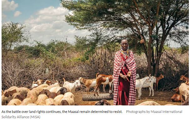
The Maasai, a prominent indigenous community in East Africa, are resisting international carbon credit projects in Tanzania. They fear these initiatives may lead to land dispossession and the erosion of their traditional pastoralist lifestyle.
Who are the Maasai?
- Ethnic Group: Semi-nomadic pastoralists found primarily in Tanzania and Kenya, especially in the Great Rift Valley and semi-arid savannas.
- Language:Maa (Eastern Sudanic branch, Nilo-Saharan family).
- Cultural Identity:
- Known for distinct attire, beadwork, and warrior traditions.
- Socially organized through patrilineal clans, divided into moieties and age-sets (from junior warriors to senior elders).
- Youth (Morans) undergo bush training for resilience and discipline.
- Livelihood:
- Rely on cattle, sheep, and goats for milk, meat, and blood.
- Practice transhumance, moving seasonally for water and pasture.
- Reside in kraals—circular enclosures with mud-dung houses and thorn fences.
Carbon Credit Projects and Rising Tensions
- Projects Involved:
- Longido and Monduli Rangelands Carbon Project (Volkswagen ClimatePartners).
- Resilient Tarangire Ecosystem Project (The Nature Conservancy).
- Area Affected: Nearly 2 million hectares of Maasai grazing land.
- Project Goal: Store soil carbon and sell offsets to polluters globally.
Maasai Concerns and Resistance
- Forced Land-Use Changes:Carbon projects impose structured rotational grazing (e.g., 14-day grazing cycles), disrupting centuries-old mobility practices.
- Lack of Consultation:Research by the Maasai International Solidarity Alliance (MISA) shows widespread violations of Free, Prior, and Informed Consent (FPIC).
- Women and youth were excluded from consultations.
- Some communities unknowingly entered 30–40 year contracts.
- Payments were often tokenistic and poorly explained.
- Economic and Legal Risks:
- Villages lack clarity on revenue shares from credits.
- Contracts lock communities into rigid systems despite village land-use plans being reviewed every 10 years.
- Intermediaries—not end buyers—dominate the agreements.
Government and Global Dimensions
- Tanzania’s Push:The government expects $1 billion/year from carbon credit sales and is streamlining the sector through the National Carbon Monitoring Centre (NCMC).
- Global Scrutiny:
- Investigations reveal over 90% of rainforest offsets by some certifiers are ineffective.
- Soil carbon in semi-arid areas (like Maasai rangelands) is volatile and hard to quantify.
Grassroots Resistance and Legal Action
- Cultural and Spiritual Attachment:Land is integral to Maasai identity, beyond livestock rearing—it holds spiritual and cultural significance.
- Legal Mobilization:Young warriors, once defending livestock from predators, now advocate legally to protect ancestral land.MISA, formed after violent evictions in 2022 (Ngorongoro, Loliondo), spearheads resistance against exploitative schemes.
India–Myanmar Free Movement Regime (FMR)
- 01 Apr 2025
In News:
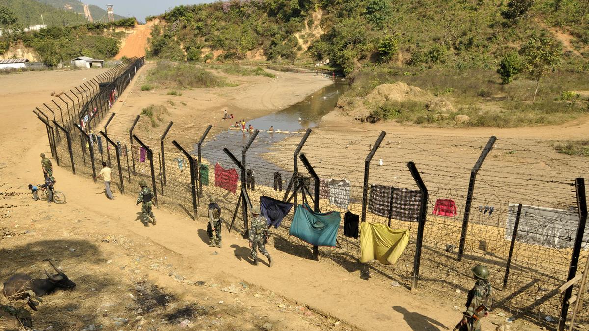
In February 2024, Union Home Minister Amit Shah announced the scrapping of the Free Movement Regime (FMR) along the India–Myanmar border, citing national security concerns. The decision is reportedly influenced by the former Manipur Chief Minister, who blamed unregulated cross-border movement for ethnic violence in Manipur. However, the decision has not yet been implemented, and no formal notification or bilateral agreement has been issued. Mizoram and Nagaland have opposed the move, highlighting socio-cultural concerns.
What is the Free Movement Regime (FMR)?
- Introduced: 1968
- Current Limit: Movement up to 16 km on either side of the 1,643 km-long India–Myanmar border
- Eligibility: Members of hill tribes on both sides with a border pass valid for one year, allowing stay for up to 2 weeks per visit
- Purpose:
- Preserve historical, cultural, and familial ties between border communities
- Facilitate local trade and people-to-people exchanges
- Complement India’s Act East Policy by promoting cross-border cooperation
- Regulations: Initially 40 km (1968), reduced to 16 km (2004), with tighter checks from 2016
- Formal Implementation: 2018
Impact on Border Communities:
- Deep Ethnic and Familial Ties: Many communities across Mizoram, Manipur, Nagaland, and Arunachal Pradesh share ancestry and cultural links with communities in Myanmar, such as the Chin and Mizo peoples.
- Local Trade & Livelihoods: FMR supports livelihoods through informal trade. Its removal could disrupt economic dependence in these remote areas.
- Perceived as Redundant: Locals report that cross-border interaction predates FMR and continues with or without official sanction.
Security Concerns and Contraband Issues:
- Despite increased military presence post the Border Area Development Programme (BADP) in the 1980s, smuggling of contraband such as drugs, gold, and areca nuts continues unabated.
- Centre’s View: FMR allegedly facilitates illegal migration, drug trafficking, and infiltration contributing to internal instability.
- Local View: Scrapping the FMR alone won’t stop cross-border crime without comprehensive border management and community engagement.
Challenges with Border Fencing:
- Difficult Terrain: The mountainous and forested landscape makes border fencing logistically and financially challenging.
- Social Sensitivity: Fencing may provoke protests as the border cuts across ethnically unified communities.
- Unified Homeland Demand: Risk of reviving separatist sentiments, especially in regions like Eastern Nagaland, where demands for Frontier Nagaland exist.
Legal and Strategic Concerns:
- The Forest (Conservation) Amendment Act, 2023 allows the use of forest land within 100 km of international borders for strategic projects, raising concerns about displacement and loss of ancestral lands.
Way Forward:
- Balanced Approach Needed:
- Any changes must consider security needs as well as local sensitivities.
- Community engagement and consultation are crucial to avoid unrest.
- Alternatives to Fencing:
- Strengthen customs and intelligence units along the border.
- Promote legal trade channels to formalize economic activities.
- Enhance monitoring mechanisms without disrupting historical ties.
- Long-Term Strategy:
- Address instability in Myanmar, Chinese influence, and Golden Triangle drug trade through coordinated regional efforts.
- Align border governance with India’s Act East Policy, focusing on connectivity and cultural diplomacy.
Mount Kenya’s Rapid Glacier Retreat due to Climate Change
- 01 Apr 2025
In News:
Mount Kenya, Africa’s second-highest peak after Kilimanjaro, is witnessing a dramatic loss of its glacial cover due to accelerating climate change. Scientists warn that the mountain may become completely ice-free by 2030.
Key Findings:
- The Lewis Glacier, once one of the most prominent ice bodies on Mount Kenya, has experienced substantial shrinkage.
- A 2011 study by the University of Innsbruck (Austria) reported a 90% volume loss in Lewis Glacier between 1934 and 2010.
- A 2023 satellite analysis revealed that only 4.2% of the ice present in 1900 remains today.
About Mount Kenya:
- Location: Central Kenya, just south of the Equator.
- Elevation:5,199 meters (17,058 feet) at its highest peak, Batian.
- Geological Nature: An extinct stratovolcano, heavily eroded over millennia.
- Glaciers: Includes Lewis Glacier and Tyndall Glacier, among the last surviving tropical glaciers in Africa.
- UNESCO Status: Declared a World Heritage Site in 1997 for its ecological and cultural value.
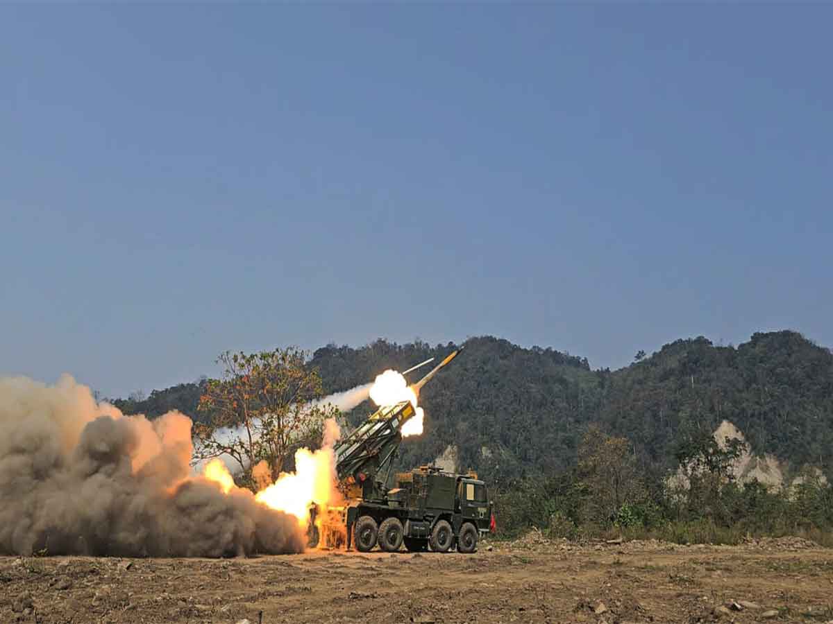
Exercise PrachandPrahar (2025)
- 01 Apr 2025
In News:
Exercise PrachandPrahar was a tri-service integrated multi-domain military exercise conducted by the Indian Armed Forces in the high-altitude terrain of Arunachal Pradesh, along the Northern Borders, specifically under the Eastern Army Command.
Timeline:
- Held: March 25–27, 2025
- Preceded by:Exercise PoorviPrahar (November 2024), which focused on integrated aviation asset application.
Objective:
To validate integrated operational capabilities of the Army, Navy, and Air Force, and enhance India's preparedness for future warfare scenarios along the 3,488-km long Line of Actual Control (LAC) with China.
Key Highlights:
- Location: High-altitude Himalayan terrain, eastern sector of the LAC in Arunachal Pradesh.
- Forces Involved:
- Indian Army (including Special Forces)
- Indian Air Force (IAF)
- Indian Navy
Major Components:
- Surveillance and Domain Awareness:
- Long-range surveillance aircraft (IAF)
- Maritime domain awareness aircraft (Navy)
- Helicopters and UAVs
- Space-based assets
- Precision Strike Capabilities:
- Fighter aircrafts
- Long-range rocket systems
- Medium artillery
- Armed helicopters
- Swarm drones
- Loitering munitions
- Kamikaze drones
- Operational Environment:
- Simulated electronic warfare and contested conditions.
- Focus on jointness, precision, and rapid response.
Strategic Importance:
- Demonstrated seamless command, control, and coordination among the three services.
- Validated the ability to conduct multi-domain operations (MDO) in challenging terrain.
- Reinforced India’s technological edge and combat readiness along strategic frontiers.