3 by 35 Initiative

- 06 Jul 2025
In News:
Amid shrinking official development assistance (ODA) and growing health burdens, the World Health Organization (WHO) has launched the 3 by 35 Initiative—a global call to action to increase taxes on three harmful products: tobacco, alcohol, and sugary drinks. The goal is to raise their real prices by at least 50% by the year 2035, tailored to each country’s context.
Why the Initiative?
- Noncommunicable Diseases (NCDs)—like cardiovascular diseases, cancers, and diabetes—are the leading cause of death and disability worldwide.
- Tobacco use causes over 7 million deaths annually; alcohol and sugary drinks significantly contribute to the global NCD burden.
- Health taxes are a proven strategy to curb harmful consumption while generating domestic revenue for health and development.
Economic Potential:
- A one-time 50% price increase via taxation could generate:
- US$ 3.7 trillion over five years
- ~US$ 740 billion per year (approx. 0.75% of global GDP)
- Estimated to raise US$ 1 trillion in public revenue over the next decade while reducing product consumption.
Key Objectives of 3 by 35:
- Reduce Harmful Consumption:
- Discourage use of tobacco, alcohol, and sugary drinks.
- Mitigate NCDs and associated healthcare costs.
- Mobilize Domestic Revenue:
- Strengthen public financing without reliance on external aid.
- Support progress toward Sustainable Development Goals (SDGs).
- Build Healthier, Resilient Economies:
- Improve economic productivity through healthier populations.
- Channel revenue toward health services, nutrition, and education.
Strategic Actions:
- Mobilize Countries:
- Engage leaders, finance and health ministries, and civil society.
- Provide platforms for peer learning and global recognition.
- Support Country-Led Policies:
- Offer technical support for health tax design, legal reform, and implementation.
- Promote evidence-based, locally tailored solutions.
- Build Commitments and Partnerships:
- Foster multi-sector collaboration and civil society engagement.
- Shift public and political narratives around health taxation.
Governance and Collaboration:
- Led by WHO and supported by:
- National governments
- Civil society and academic institutions
- Development partners and multilateral organizations
C-FLOOD
- 06 Jul 2025
In News:
In a significant advancement in disaster risk management, Union Minister of Jal Shakti Shri C.R. Patil inaugurated C-FLOOD, a Unified Inundation Forecasting System. Developed under the National Supercomputing Mission (NSM), C-FLOOD marks a pivotal step toward strengthening India's flood preparedness and mitigation strategy.
What is C-FLOOD?
C-FLOOD is a web-based, real-time flood forecasting platform designed to deliver two-day advance inundation forecasts at village-level resolution. It provides:
- Flood inundation maps
- Water level predictions
- Localized early warnings to support disaster response and planning.
Developing Agencies:
- Centre for Development of Advanced Computing (C-DAC), Pune
- Central Water Commission (CWC)
- National Remote Sensing Centre (NRSC)
Developed in collaboration with the Ministry of Jal Shakti, Ministry of Electronics & IT (MeitY), and Department of Science & Technology (DST).
Key Features:
- 2-Day Village-Level Forecasts: Localized and high-resolution predictions up to the gram panchayat level.
- Advanced 2-D Hydrodynamic Modelling: Simulations run on High-Performance Computing (HPC) systems under NSM.
- Multi-Basin Coverage: Initially operational in the Mahanadi, Godavari, and Tapi river basins, with future expansion planned.
- Unified Data Integration: Combines outputs from national and regional flood models into one platform.
- Disaster Portal Linkage: Designed for integration with the National Disaster Management Emergency Response Portal (NDEM).
- Climate-Adaptive Governance: Supports flood forecasting in regions vulnerable to climate-induced extreme weather events.
Strategic Importance:
- Disaster Risk Reduction: Enables timely warnings, efficient evacuations, and minimizes loss of life and property.
- Scientific & Operational Integration: Bridges hydrological modelling with on-ground responses.
- Supports Viksit Bharat @2047 Vision: Contributes to climate-resilient water governance.
- Promotes Inter-Agency Synergy: Encourages coordination among CWC, C-DAC, NRSC, and disaster management bodies.
Government Directions and Future Path:
During the inauguration, the Union Minister emphasized:
- Wide dissemination of C-FLOOD to enhance public awareness.
- Expansion to all major river basins through comprehensive inundation studies.
- Improved accuracy via satellite data validation and ground-truthing.
- Integration with NDEM for real-time emergency response.
The minister lauded the collaborative spirit of CWC, C-DAC, and NRSC, and reaffirmed the government's commitment to proactive and technology-driven disaster management.
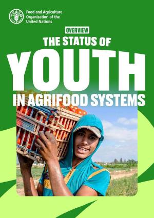
Status of Youth in Agrifood Systems
- 06 Jul 2025
In News:
The Food and Agriculture Organization (FAO) has released the “Status of Youth in Agrifood Systems” report, emphasizing that youth empowerment in agriculture could significantly reduce global unemployment and enhance food security, with the potential to boost global GDP by 1.4% (approx. $1.5 trillion).
Key Insights from the Report:
Declining Youth Engagement in Agriculture:
- The share of youth employed in agrifood systems has dropped from 54% in 2005 to 44%, even though many low-income countries remain heavily dependent on youth labour in agriculture.
Youth NEET Crisis:
- Over 20% of global youth (ages 15–24) are Not in Employment, Education, or Training (NEET).
- Young women are twice as likely to fall into this category compared to men.
- Addressing NEET status, particularly among those aged 20–24, could raise global output, with 45% of potential gains stemming from agrifood-related employment.
Urban-Rural Divide:
- 54% of youth now reside in urban areas, while only 5% of rural youth participate in industrial agrifood systems — posing challenges for future agricultural labour availability.
Climate Vulnerability:
- Around 395 million rural youth live in regions projected to experience reduced agricultural productivity due to climate change and extreme weather events.
Rising Food Insecurity Among Youth:
- Youth facing moderate to severe food insecurity has grown from 16.7% (2014) to 24.4% (2023), with severe impacts in Africa and conflict-affected areas.
FAO’s Strategic Recommendations:
Inquire More:
- Close data gaps related to youth roles in agrifood systems.
- Promote evidence-based, youth-responsive policies.
Include More:
- Ensure youth participation in decision-making at local, national, and international levels.
- Foster inclusive governance for both rural and urban youth.
Invest More:
- Job Creation: Facilitate decent employment opportunities on farms and in agrifood value chains.
- System Modernization: Invest in rural infrastructure, digital tools, and agricultural innovation.
- Resource Access: Improve youth access to land, credit, markets, training, and technology.
- Safe Migration: Develop regulated migration pathways for youth involved in agriculture and related sectors.
Russia recognizes Taliban-led Government in Afghanistan

- 06 Jul 2025
In News:
Russia has become the first nation to officially recognize the Taliban-led Islamic Emirate of Afghanistan, formalizing diplomatic relations with the regime that took control in 2021.
Context and Significance:
- This development comes amid limited international recognition of the Taliban government, which took over Kabul in 2021 after the withdrawal of U.S. and NATO forces.
- Russia’s move could reshape regional diplomacy in Central and South Asia, potentially influencing other neighboring powers like China, Iran, and the UAE, which has also shown warming ties.
- The decision also reflects Russia's strategic interests in counterterrorism cooperation, regional stability, and its broader geopolitical competition with the West.
Profile of Russia
Geographical Overview:
- Continent: Northern Eurasia, straddling both Eastern Europe and Northern Asia
- Area: Approximately 17 million square kilometers, making it the largest country in the world
- Time Zones: Spans across 11 time zones
- Capital City: Moscow
Neighbours and Boundaries:
- Land Borders: Shares land borders with 16 countries—more than any other nation:
- In Europe: Norway, Finland, Estonia, Latvia, Lithuania, Poland (via Kaliningrad), Belarus, Ukraine
- In Asia: Georgia, Azerbaijan, Kazakhstan, Mongolia, China, North Korea
- Maritime Borders:
- United States (via the Bering Strait)
- Japan (via the Sea of Okhotsk)
- Major Mountain Ranges:
- Ural Mountains: Traditional boundary between Europe and Asia
- Caucasus Mountains: Includes Mount Elbrus, Europe’s highest peak
- Altai, Sayan, and Kamchatka ranges in Siberia
- Key Rivers and Lakes:
- Volga River: Longest river in Europe
- Lena, Yenisei, and Ob Rivers: Flow through Siberia into the Arctic Ocean
- Lake Baikal: World’s deepest and oldest freshwater lake
- Lake Ladoga: Largest lake in Europe by area
- Climatic and Vegetation Zones:
- Encompasses tundra, taiga (boreal forest), steppes, and semi-deserts
- Permafrost regions in Siberia restrict infrastructure and habitation
Roll Cloud

- 06 Jul 2025
In News:
A striking atmospheric event unfolded over Portugal’s coastline during a severe European heatwave, where beachgoers and weather enthusiasts witnessed a rare roll cloud. The phenomenon occurred as cooler Atlantic air met the hot, dry continental air, producing a visually stunning and scientifically intriguing cloud formation.
What is a Roll Cloud?
A roll cloud is an uncommon, tube-shaped, low-altitude cloud formation that appears to rotate horizontally along its axis. Unlike funnel clouds, it is not connected to any thunderstorm base or rotating system.
Typical Occurrence Zones:
- Frequently spotted in coastal areas, particularly where oceanic and continental air masses interact
- Notably seen in regions like:
- U.S. Great Plains
- Gulf of Carpentaria, Australia (famous for “Morning Glory” clouds)
- Atlantic coasts of Europe
Formation Mechanism:
- Air Mass Interaction: Roll clouds develop when cool, moist maritime air confronts hot, dry air from land, creating instability.
- Temperature Inversion: A thermal inversion layer traps cooler air beneath a warmer layer, suppressing vertical air movement.
- Gravity Waves: As dense cool air undercuts warm air, it creates gravity waves—oscillations within the lower atmosphere.
- Adiabatic Cooling: The ascending portion of the wave cools rapidly, leading to condensation and cloud formation.
- Detached Structure: The cloud remains independent of any parent cloud system, often forming a long, horizontal roll.
Cloud Characteristics:
- Shape: Long, tubular, and low-lying—can stretch over hundreds of kilometers
- Motion: Appears to roll horizontally like a barrel
- Timing: Often forms during early morning hours
- Orientation: Aligns with low-level wind flow, sometimes influenced by sea breeze or nocturnal land breeze fronts
Why are Roll Clouds important?
- Serve as visual indicators of atmospheric instability and changing weather conditions
- Though not hazardous, they reflect mesoscale meteorological processes
- May signal localized shifts in temperature or wind that could precede storm activity in some environments
- Their presence also highlights the interplay between land-sea thermal contrasts, especially relevant in the context of climate variability