Mission Drishti by GalaxEye
- 05 May 2026
In News:
In a milestone for the Indian private space sector, Bengaluru-based startup GalaxEye has successfully launched ‘Mission Drishti’, the world’s first OptoSAR satellite. Launched aboard a SpaceX Falcon 9 rocket from Vandenberg, California, this mission represents a paradigm shift in Earth observation (EO), moving beyond the limitations of traditional imaging to provide high-clarity, all-weather data.
The Innovation: OptoSAR Technology
The core of Mission Drishti lies in its unique OptoSAR platform—the first of its kind globally. Traditional satellites typically use either optical sensors (which rely on sunlight) or radar (which can be difficult to interpret). Mission Drishti integrates both on a single platform:
- Synthetic Aperture Radar (SAR): An active sensor that can "see" through thick cloud cover, smoke, and total darkness.
- Electro-Optical (EO) Sensors: Provide high-resolution, intuitive visual details in various spectral bands.
By fusing these two datasets, the satellite provides "analysis-ready" imagery. This fusion eliminates the need for complex, time-consuming post-processing, allowing decision-makers to access fused data that is inherently aligned.
Technical Specifications and Launch Details
Mission Drishti is a testament to India's growing indigenous space-tech capabilities, supported and facilitated by IN-SPACe (Indian National Space Promotion and Authorization Center).
- Mass and Scale: At 190 kg, it holds the distinction of being India’s largest privately developed Earth observation satellite.
- Orbit: It operates in a Sun-synchronous Low Earth Orbit (LEO) at an altitude of approximately 500 km.
- Resolution and Spectrum: The satellite offers a spatial resolution of 1.2 to 3.6 meters. It operates across multiple spectral bands, including X-Band (SAR), PAN (Panchromatic), RGB, NIR (Near-Infrared), Coastal Blue, and Red Edge.
- Revisit Frequency: The satellite is designed for high-frequency monitoring, capable of revisiting the same geographic location every 4 days.
Strategic Significance for India and Global Stakeholders
The deployment of Mission Drishti addresses critical gaps in current orbital monitoring, particularly for tropical regions:
1. All-Weather Capability:Standard optical satellites are often rendered ineffective by cloud cover. For a country like India, which experiences heavy monsoons and frequent cloud cover, OptoSAR ensures uninterrupted surveillance and data collection throughout the year.
2. Dual-Use Applications:As a dual-use satellite, its data serves both civilian and strategic sectors:
- National Security & Defense: Monitoring borders and maritime boundaries regardless of lighting or weather conditions.
- Disaster Management: Real-time assessment of floods or cyclones where clouds typically obstruct conventional satellites.
- Environmental & Infrastructure: High-resolution monitoring for urban planning, agriculture, and red-edge sensing for vegetation health.
Mission Drishti
- 17 Oct 2025
In News:
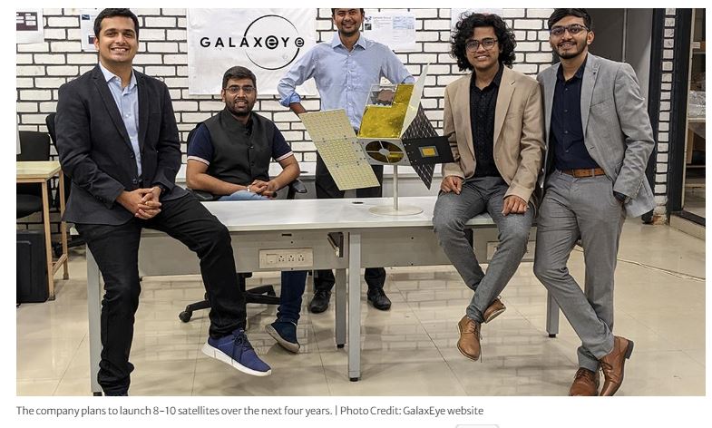
India’s private space sector is set to achieve a major milestone with GalaxEye, a Bengaluru-based space-tech start-up, preparing to launch the world's first multi-sensor Earth observation (EO) satellite, Mission Drishti, in early 2026. The mission marks a significant step toward creating an advanced satellite constellation for real-time, high-precision geospatial intelligence.
About Mission Drishti
- World’s first multi-sensor EO satellite combining Synthetic Aperture Radar (SAR) and high-resolution optical imaging on a single platform.
- Built by GalaxEye — one of India’s leading private space-tech start-ups.
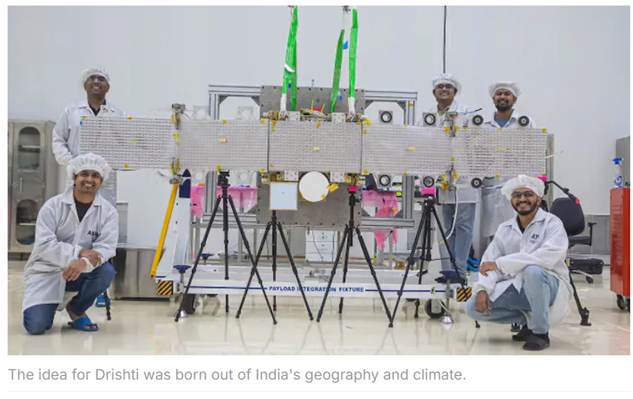
- India’s largest privately-built satellite and the highest-resolution satellite (1.5 m) developed in the country.
- Mass: ~160 kg.
- Underwent successful structural tests at ISRO’s U R Rao Satellite Centre, proving its ability to withstand harsh space conditions.
- Mission Drishti is the first step in deploying a constellation of 8–12 satellites by 2029 (company target: 8–10 in next four years).
Key Features & Technological Significance
- Dual Payload Technology: SAR + optical sensors enable:
- Imaging in all weather conditions
- Day and night coverage
- High-precision, multi-layered data
- High-resolution EO imagery optimized across spatial, spectral, and temporal dimensions.
- Enables actionable multisource imaging intelligence—a capability currently unexplored globally.
According to the company, Mission Drishti opens a new era in satellite imaging by fusing multiple sensing technologies to provide real-time situational awareness.
Applications
Mission Drishti aims to strengthen high-end geospatial capabilities across national and commercial sectors:
|
Sector |
Use-case |
|
Defence& Security |
Border surveillance, tactical intelligence |
|
Disaster Management |
Floods, landslides, cyclone & emergency monitoring |
|
Infrastructure & Utilities |
Structural health monitoring, urban planning |
|
Agriculture |
Crop monitoring, precision farming support |
|
Finance & Insurance |
Risk assessment, disaster claim validation |
The mission aligns with rising global demand for accurate Earth observation data, especially amid geopolitical tensions and climate-driven emergencies.
Significance for India’s Space Ecosystem
- Enhances India’s capabilities in commercial EO intelligence, traditionally dominated by the US & Europe.
- Strengthens private-sector participation under India’s space reforms and IN-SPACe framework.
- Potential to integrate AI and advanced imaging analytics, improving decision-making in governance and industry.
- Boosts India’s aspiration to become a global space-technology provider.