Super Typhoon Ragasa
- 26 Sep 2025
In News:
Super Typhoon Ragasa—locally known as Nando—has emerged as one of the most powerful storms to strike Southeast Asia in recent years. With sustained winds exceeding 200 km/h and gusts up to 250 km/h, it has prompted large-scale shutdowns across the Philippines and Hong Kong, highlighting the region’s vulnerability to climate-induced extreme weather events.
About Super Typhoon Ragasa
- Category: 5 (the highest on the Saffir-Simpson scale)
- Wind Speed: Sustained winds of around 205 km/h, gusting up to 250 km/h.
- Origin: Formed over the western Pacific Ocean, where warm sea surface temperatures and low wind shear facilitated rapid intensification.
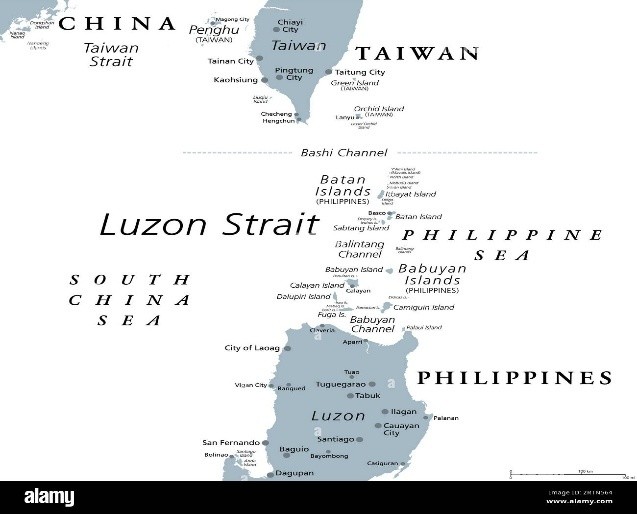
- Track: Moving northwestward across the Luzon Strait, impacting the Babuyan Islands in northern Philippines before heading toward southern China, including Hong Kong.
Regional and Environmental Significance
- The increasing intensity of storms like Ragasa reflects the broader pattern of climate change-driven extreme weather in the western Pacific region.
- Rising sea surface temperatures and shifting atmospheric circulation patterns have led to more frequent and severe typhoons, posing long-term challenges to disaster preparedness and coastal infrastructure resilience in densely populated regions like Luzon and Hong Kong.
Way Forward
- Strengthening Early Warning Systems: Enhanced forecasting and community-based alert dissemination can save lives in coastal and island regions.
- Climate Adaptation Infrastructure: Investment in storm-resilient housing, flood barriers, and sustainable urban planning is critical for mitigating recurring damage.
- Regional Cooperation: Shared meteorological data and coordinated disaster response among ASEAN nations, China, and Pacific island states can improve resilience.