Afghanistan Earthquake
- 07 Sep 2025
In News:
A devastating 6.0-magnitude earthquake struck eastern Afghanistan near Jalalabad, killing over 800 people and injuring at least 2,800 across Kunar, Nangarhar, and Laghman provinces. The tremors, felt from Kabul to Islamabad, destroyed homes in remote mountainous regions and highlighted Afghanistan’s acute vulnerability to natural disasters.
Afghanistan’s Seismic Vulnerability
Afghanistan lies at the collision zone of the Eurasian and Indian tectonic plates, making it one of the world’s most seismically active regions. The Hindu Kush mountain range, part of the greater Himalayan system, witnesses frequent tremors. Since 1900, at least 12 earthquakes exceeding magnitude 7 have struck northeast Afghanistan.
Most Afghans live in low-rise, mud-brick dwellings, which offer little resistance to seismic shocks. With poor infrastructure, fragile governance, and limited access to technology, the human toll of disasters is amplified.
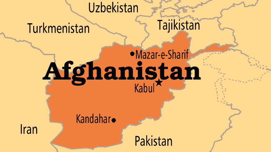
Geographic and Geostrategic Context
Afghanistan is a landlocked, multi-ethnic nation in South-Central Asia, historically situated at the crossroads of trade and power rivalries—from the “Great Game” between Britain and Russia to Cold War confrontations.
- Capital: Kabul
- Neighbours: Pakistan, Iran, Turkmenistan, Uzbekistan, Tajikistan, and China (via the narrow Wakhan Corridor).
- Geographic Features:
- Mountains: The Hindu Kush dominates, with passes like the Khyber and Shebar, linking Central and South Asia.
- Rivers: Amu Darya (north), Kabul River (tributary of Indus), Helmand (longest at 715 miles), and Hari Rud (Afghanistan–Iran boundary).
- Regions:
- Central Highlands – rugged, earthquake-prone terrain.
- Northern Plains – fertile, resource-rich areas with gas reserves.
- Southwestern Plateau – arid deserts such as Registan and Margow.
These geographical features make Afghanistan both strategically significant and highly disaster-prone.