World Soil Day (WSD)
- 07 Dec 2025
In News:
World Soil Day (WSD) is observed annually on 5 December to raise global awareness about the importance of healthy soils and to promote the sustainable management of soil resources. The observance is supported by the Food and Agriculture Organization (FAO) of the United Nations and endorsed by the UN General Assembly (UNGA).
History and Background
- The idea of a global day dedicated to soil conservation was first proposed in 2002 by the International Union of Soil Sciences (IUSS).
- FAO promoted the initiative, and in 2013 the FAO Conference endorsed the proposal and sought formal UN recognition.
- The UN General Assembly officially designated 5 December 2014 as the first World Soil Day.
Theme for 2025
“Healthy Soils for Healthy Cities”
The 2025 theme highlights the critical role of urban soils in supporting sustainable cities. It shifts attention from rural agriculture to the often-overlooked soils beneath urban environments.
Importance of Healthy Soils
Soils are a life-sustaining resource essential for:
- Food production
- Water filtration and groundwater recharge
- Carbon storage and climate regulation
- Biodiversity support
- Nutrient cycling
In urban areas, healthy soils help mitigate:
- Urban heat island effect
- Flooding by acting as natural water sponges
- Pollution through filtration of contaminants
- Food insecurity through urban agriculture
Extent of Soil Degradation
Despite their importance, soils are under severe stress:
- The FAO estimates that nearly one-third of the world’s soils are degraded.
- Urban soils face compaction, contamination, and sealing by concrete, reducing their ecological functions.
- Unsustainable agricultural practices, deforestation, and land misuse further worsen soil erosion and nutrient depletion.
Global Soil Conservation Efforts
1. Global Soil Partnership (GSP):An FAO-led initiative aimed at improving soil governance and promoting sustainable soil management worldwide.
2. United Nations Convention to Combat Desertification (UNCCD):Works to prevent land degradation and achieve Land Degradation Neutrality (LDN) by 2030.
India’s Soil Conservation Initiatives
India has launched multiple programmes to protect and restore soil health:
- Soil Health Card Scheme: Provides farmers with soil nutrient analysis to encourage balanced fertiliser use.
- Paramparagat Krishi Vikas Yojana (PKVY): Promotes organic farming to maintain soil fertility.
- Pradhan Mantri Krishi Sinchayee Yojana (PMKSY): Improves water management and reduces soil erosion.
- Watershed Development Programmes: Enhance soil moisture and prevent land degradation.
- MGNREGA land works: Support soil and water conservation at the local level.
- Smart Cities Mission: Encourages green infrastructure, open spaces, and soil-friendly urban planning.
Binding DDT-Infused Soil with Biochar
- 18 Jan 2025
In News:
A three-year study was conducted on a 23-hectare DDT-contaminated former tree nursery in southern Sweden. Researchers mixed biochar into sections of the contaminated soil and planted different crops, including pumpkins, legumes, grasses, and willows.
Key findings:
- Reduction of DDT Uptake: The presence of biochar reduced DDT absorption by soil organisms, cutting the toxin uptake by earthworms in half.
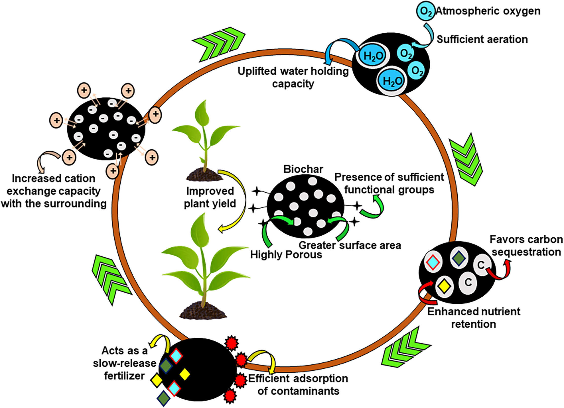
- Enhanced Soil Health: Biochar improved soil structure, fertility, and microbial activity.
- Cost-Effective Alternative: Unlike traditional soil removal methods, which are expensive and labor-intensive, biochar treatment offers a sustainable and economical approach.
- Support for Renewable Energy: The method allows for the growth of bioenergy crops such as willow trees, further contributing to environmental benefits.
Implications for Future Agricultural Practices
This breakthrough provides a viable approach to rehabilitate contaminated lands worldwide. Many regions, including India, still grapple with DDT contamination. While India banned agricultural use of DDT in 1972, it continues to be used for disease control under strict regulations. The application of biochar could significantly aid in soil restoration and sustainable land management
About DDT
- Dichlorodiphenyltrichloroethane (DDT) is a synthetic insecticide first introduced in 1939. It was widely used in agriculture and public health initiatives to control vector-borne diseases like malaria.
- However, despite its effectiveness against pests, DDT’s persistence in the environment led to severe ecological and health concerns.
- It degrades slowly, accumulates in fatty tissues, and disrupts ecosystems by affecting soil fertility, harming wildlife, and posing potential human health risks, including endocrine disruption and carcinogenic effects.
Challenges Posed by DDT-Contaminated Soils
The prolonged use of DDT has resulted in extensive soil contamination, making land infertile and unsuitable for cultivation. Conventional methods of decontamination, such as soil excavation and disposal, are expensive and environmentally unsustainable.
Biochar as a Solution
Researchers at Sweden’s Chalmers University of Technology have developed an innovative method to restore DDT-contaminated soils by integrating biochar.
What is Biochar?
Biochar is a charcoal-like material produced by burning organic waste in a controlled oxygen-limited environment (pyrolysis). It is known for its ability to enhance soil quality, bind contaminants, and store carbon for extended periods.
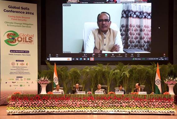
Global Soil Conference 2024
- 23 Nov 2024
In News:
- Global Soil Conference (GSC) 2024 held in New Delhi.
- Focused on soil health's importance for food security, climate change mitigation, and ecosystem services.
What is the Global Soil Conference 2024?
- Organizers: Indian Society of Soil Science (ISSS) in collaboration with the International Union of Soil Sciences (IUSS).
- Objective: Address sustainable soil/resource management challenges and foster global dialogue.
- Theme: "Caring Soils Beyond Food Security: Climate Change Mitigation & Ecosystem Services."
Key Highlights of GSC 2024:
- Soil Health Issues:
- Soil degradation threatens productivity and global food security.
- 30% of India's soil is compromised by erosion, salinity, pollution, and organic carbon loss.
- Soil erosion is linked to SDG 15 (Sustainable Development Goal 15), aiming to protect terrestrial ecosystems.
- SDG 15:
- Goals: Promote sustainable land use, combat desertification, halt land degradation, protect biodiversity.
Concerns Regarding Soil Health in India:
- Soil Degradation:One-third of India's land faces degradation due to poor farming practices.
- Soil Erosion & Fertility Loss:
- India loses 15.35 tonnes of soil/hectare annually.
- Results in crop losses, economic damage, and environmental issues like floods and droughts.
- Soil Salinity:Reduces water infiltration, nutrient uptake, and aeration, making land infertile.
- Low Organic Content:
- Organic carbon in Indian soil is 0.54%, which hampers fertility.
- Over 70% of soils are affected by acidity or alkalinity, disrupting nutrient cycles.
- Desertification:Reduces soil fertility, increases erosion, and worsens food insecurity.
- Diversion of Fertile Land:Fertile agricultural land is diverted for non-agricultural purposes.
India's Initiatives for Soil Conservation:
- Soil Health Card (SHC) Scheme:Provides farmers with soil nutrient information.
- Pradhan Mantri Krishi Sinchai Yojana:Focuses on efficient water use.
- Zero Budget Natural Farming & Natural Farming Mission:Promotes sustainable farming practices to protect soil health.
Survey of India (SoI)
- 23 Apr 2024
Why is it in the News?
The Tamil Nadu government filed its objections in the Supreme Court recently, about the Survey of India (SOI) report on the construction of the mega car parking project near the Mullaiperiyar dam, and sought rejection of the report.
What is the Survey of India (SoI)?
- The Survey of India (SoI) serves as the National Survey and Mapping Organization of India, operating under the Department of Science and Technology.
- Established in 1767, it holds the distinction of being the oldest scientific department within the Government of India.
- Tasked with the critical role of being the country's primary mapping agency, SoI bears the responsibility of thoroughly exploring and mapping India's terrain to furnish foundational maps for comprehensive and efficient development initiatives.
- Originally comprising only five directorates in 1950, primarily focused on catering to the mapping requirements of the Defense Forces in the Northwest and Northeast regions, the department has since expanded to encompass 18 directorates spread across the nation, ensuring comprehensive map coverage essential for national development.
- SoI's expertise is widely utilized by various ministries and government undertakings for diverse purposes, including delineating international borders, and state boundaries, and facilitating the planned development of previously underserved areas.
- Moreover, SoI actively contributes to numerous national scientific endeavors in fields such as geophysics, remote sensing, and digital data transmission.
- Functioning as a key advisor to the Government of India on all survey-related matters, including geodesy, photogrammetry, mapping, and map reproduction, SoI fulfills a multitude of duties and responsibilities, which include:
- Conducting all geodetic control, geodetic, and geophysical surveys.
- Undertaking topographical control, surveys, and mapping within India.
- Producing geographical maps and aeronautical charts.
- Conducting surveys for developmental projects.
- Mapping forests, cantonments, large-scale city surveys, guide maps, cadastral surveys, etc.
- Engaging in surveys and mapping for specialized purposes.
- Demarcating India's external boundaries, depicting them on published maps, and advising on inter-state boundary demarcation.
- Conducting research and development in cartography, printing, geodesy, photogrammetry, topographical surveys, and indigenization.
- Predicting tides at 44 ports, including 14 foreign ports, and publishing tide tables one year in advance to support navigational activities.
- Reviewing and certifying India's external boundaries and coastline on maps published by other entities, including private publishers.
- Headquartered: Dehradun (Uttarakhand)