Zagros Mountains and Iraq’s Tectonic Subsidence
- 27 Feb 2025
In News:
Recent geological studies have found that the hilly region around the Zagros Mountains in northern Iraq is slowly sinking into the Earth, a process attributed to ancient tectonic dynamics. This discovery has implications for earthquake prediction and geothermal energy potential.
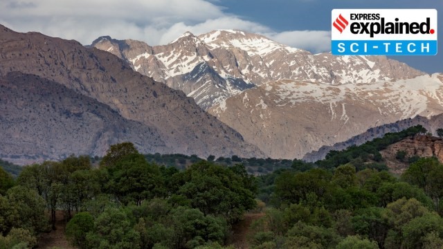
Zagros Mountains
- Location: Stretches ~1,500 km from eastern Turkey and northern Iraq across the Iranian Plateau to the Strait of Hormuz.
- Highest Peak: Mount Dena (4,409 m / 14,465 ft).
- Geological Composition: Primarily limestone and shale from the Mesozoic Era and Paleogene Period.
- Climate: Semi-arid temperate – cold winters and dry, arid summers.
- Vegetation: Dominated by oak and pistachio trees with steppe vegetation.
Geological Process Behind Iraq’s Sinking
- The Zagros region is influenced by the tectonic collision between the Arabian and Eurasian Plates.
- A sinking oceanic slab, part of the ancient Neotethys Ocean floor (over 66 million years old), is pulling the region down.
- This slab is subducting beneath the Eurasian Plate, a process occurring over tens of millions of years, making it imperceptible in human timescales.
Research Insights
- The studyused rock records, sediment analysis, and deep-earth imaging to understand the tectonic architecture of the region.
- The findings explain why the depressions around the Zagros Mountains are deeper than the current topography would suggest.
Significance of the Study
- Helps develop precise geological models critical for:
- Earthquake prediction – by understanding fault depths and configurations.
- Geothermal energy exploration – estimating areas with high geothermal gradients.
- Especially relevant in a region prone to seismic activity (e.g., 2023 Turkey-Syria earthquakes).