Mayon Volcano Eruption
- 07 May 2026
In News:
As of May 2026, the Mayon Volcano in the Philippines remains under Alert Level 3, indicating a high level of volcanic unrest. The current eruptive phase, which began in late 2025, has recently intensified, with satellite data from the Philippine Space Agency (PhilSA) confirming that ashfall and pyroclastic flows have affected over 1,000 hectares of farmland and buried more than 120 villages in Albay province.
Mayon Volcano: The "Perfect Cone" Stratovolcano
Located in the Albay province on the island of Luzon, Mayon is the most active volcano in the Philippines. It is globally recognized for its near-perfect symmetrical cone, a physical characteristic that also makes it highly dangerous.
- Classification: It is a stratovolcano (or composite volcano), characterized by a steep profile and periodic explosive and effusive eruptions. Its structure is built from alternating layers of hardened lava, tephra, and volcanic ash.
- Eruption Profile: Mayon typically exhibits Strombolian activity—relatively mild but frequent bursts of glowing lava. However, it is also prone to more hazardous phenomena:
- Pyroclastic Density Currents (PDCs): Locally known as uson, these are fast-moving clouds of extremely hot gas and volcanic debris.
- Lahars: Mudflows triggered by heavy rainfall mixing with accumulated volcanic ash, which can bury entire communities.
- Historical Context: Its most destructive eruption occurred in February 1814, when ash and lava buried the town of Cagsawa, resulting in over 1,200 fatalities.
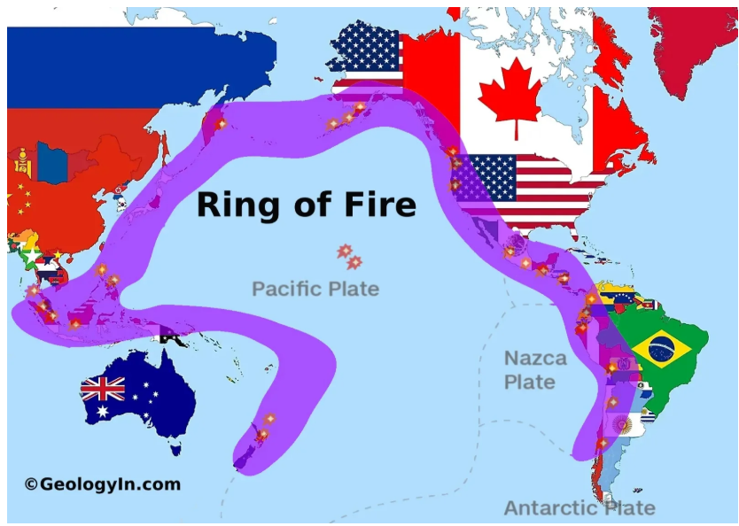
The Geologic Driver: The Pacific Ring of Fire
The persistent activity of Mayon is a direct consequence of its location on the Pacific Ring of Fire (Circum-Pacific Belt).
- Definition: A horseshoe-shaped zone stretching approximately 40,000 kilometers, home to roughly 75% of the world’s active volcanoes and the source of 90% of global earthquakes.
- Tectonic Mechanism: The activity is driven by plate tectonics, specifically subduction zones. In the Philippines, the Philippine Sea Plate is being subducted beneath the Philippine Mobile Belt. As the oceanic plate sinks into the mantle, it melts, and the resulting magma rises to the surface, creating volcanic chains.
- Geographic Scope: The belt extends from the southern tip of South America, through the West Coast of North America, across the Aleutian Islands, and down through Japan, the Philippines, Indonesia, and New Zealand.
2026 Eruption: Impact and Disaster Management
The current unrest has triggered significant socio-economic disruptions, emphasizing the importance of disaster resilience in volcanic regions.
- Evacuations and Safety Zones: Authorities have enforced a 6-kilometer Permanent Danger Zone (PDZ). Over 200,000 residents have been affected, with thousands relocated to emergency shelters.
- Aviation and Visibility: Massive ash plumes have restricted airspace near Manila. On the ground, ashfall has turned roads into "grey seas," reducing visibility to near-zero and necessitating the use of specialized clearing equipment.
- Agricultural Loss: Pyroclastic flows in May 2026 destroyed over 1,039 hectares of rice crops, threatening local food security in the Bicol region.
- Monitoring Infrastructure: The Philippine Institute of Volcanology and Seismology (PHIVOLCS) utilizes real-time monitoring, including seismic sensors and satellite imagery, to track magma ascent and predict potential explosive pulses.